Published Research
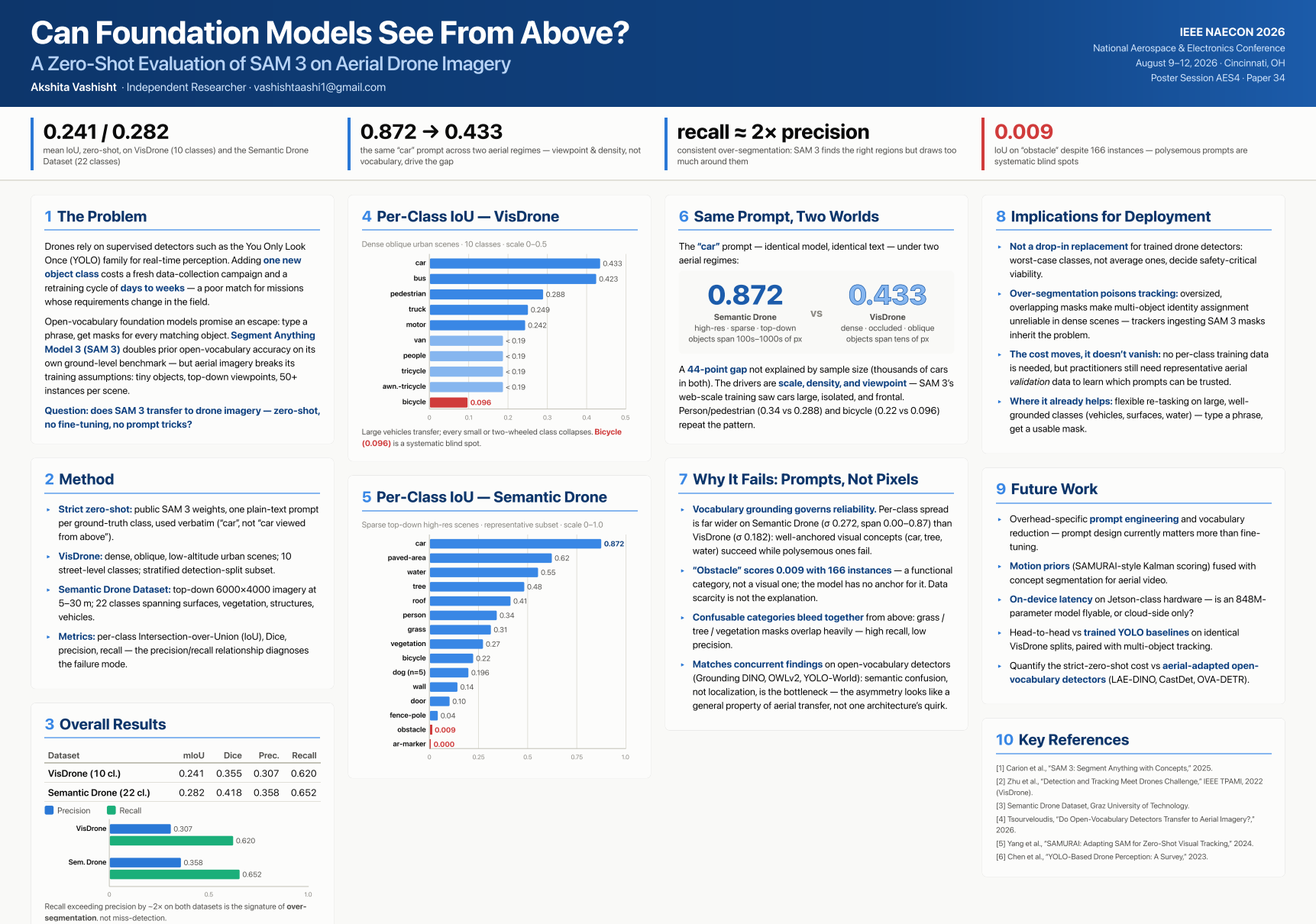
Evaluating SAM 3 on Drone Imagery
Testing the Segment Anything Model 3 on aerial footage — with direct applications to water infrastructure mapping and beyond.
About the Research
This independent research project focused on evaluating SAM 3 — Meta's Segment Anything Model 3 — on drone imagery to assess how well it segments and identifies objects in aerial footage. The work has direct applications to projects like water infrastructure mapping, where accurate object detection from above is critical.
The research involved designing evaluation protocols, running the model against drone datasets, and analyzing segmentation performance across varied terrain and lighting conditions. Findings were compiled into a full research paper.
IEEE Xplore Published ResearchIEEE NAECON Presentation
The paper was selected by IEEE for presentation at NAECON — the National Aerospace and Electronics Conference, the oldest aerospace conference in the United States. I presented a poster in Cincinnati, Ohio from August 9–12, 2026, connecting with researchers and professionals across the aerospace and defense industry.
The conference brought together leading voices in aerospace electronics, defense systems, and AI applications — providing a rare opportunity to share this work with an expert audience and receive direct feedback from the field.
Why It Matters
Foundation models like SAM 3 are increasingly being applied to real-world engineering problems. Understanding their strengths and limitations on drone imagery is essential for anyone building systems that rely on aerial object detection — from water infrastructure mapping to disaster response and precision agriculture.
Quick Facts
- ModelSAM 3 (Segment Anything Model 3)
- Data TypeDrone / aerial imagery
- Potential ApplicationsWater infrastructure mapping Search and Resuce
- VenueHotel Hilton Netherlands Plaza, Cincinnati, OH
- FormatPoster presentation
- LocationCincinnati, OH
- PublicationIEEE Xplore Published Research
Skills Applied
Conference
National Aerospace and Electronics Conference — the oldest aerospace conference in the United States.
naecon.org